FREQUENTLY ASKED QUESTIONS
MAVI Solutions is a team at Sentient that specialises in creating visualisations for the purposes of stakeholder engagement, approvals processes, tender applications, marketing and communications and reporting. The team utilises spatially accurate 3D maps, 2D & 3D animations, immersive technologies and interactive tools to transform complex project information into clear, engaging visual stories for all stakeholders, whether internal or external. The MAVI Solutions team also creates engaging, fun and informative activities for conferences and exhibitions.
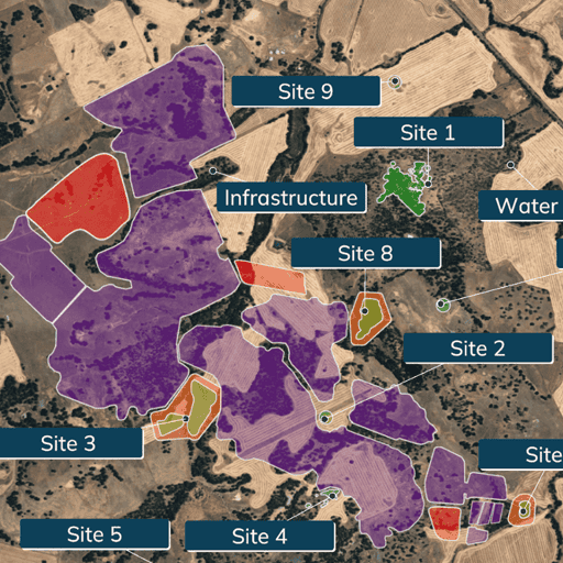
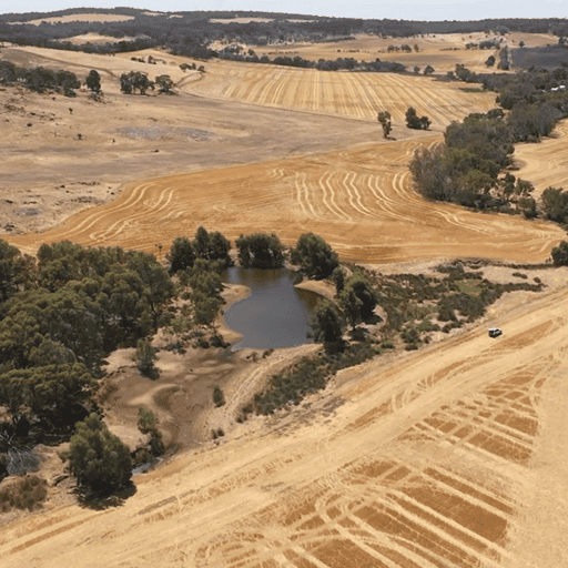
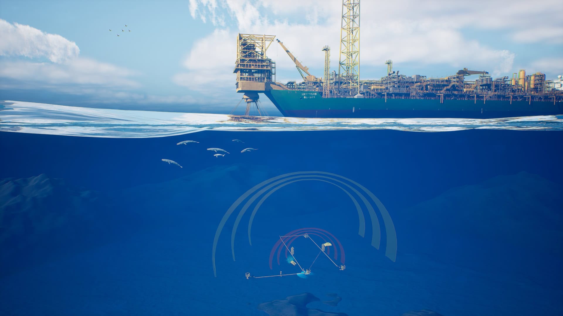
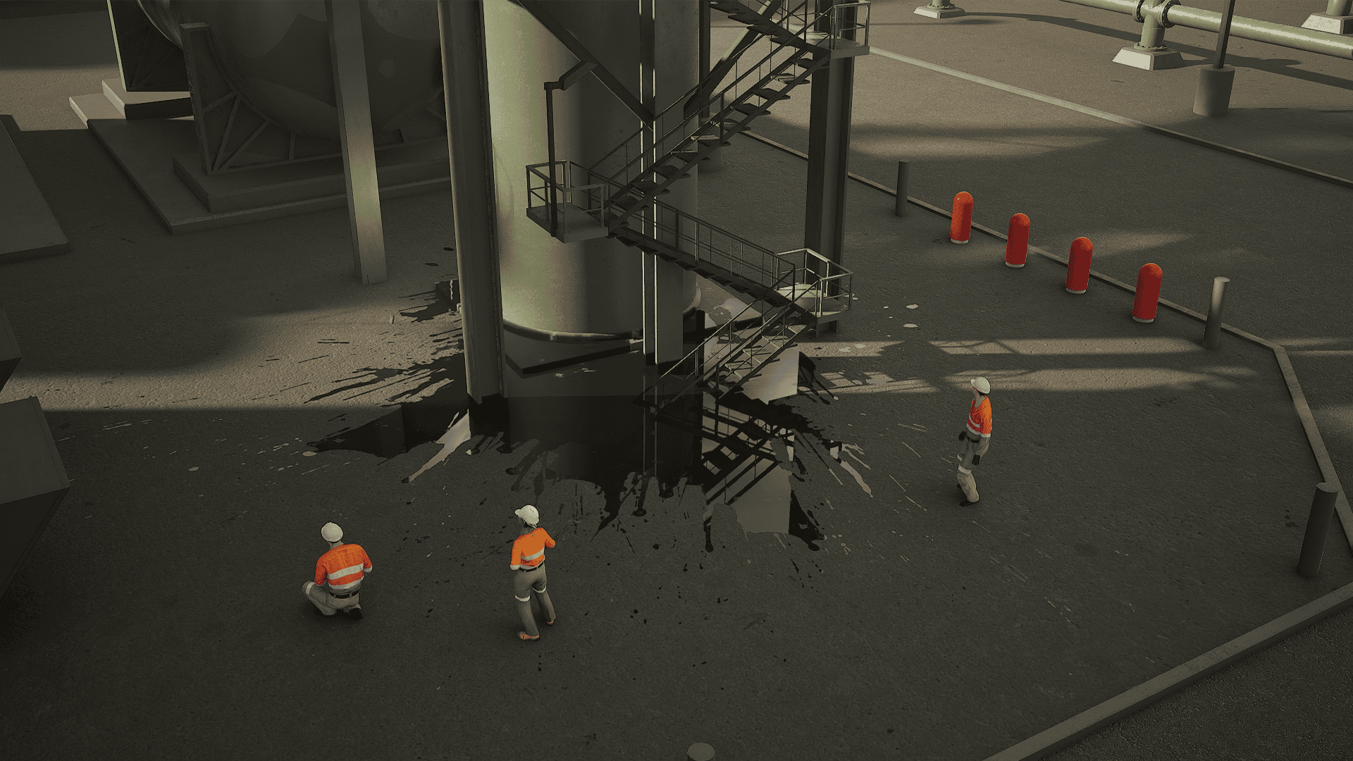
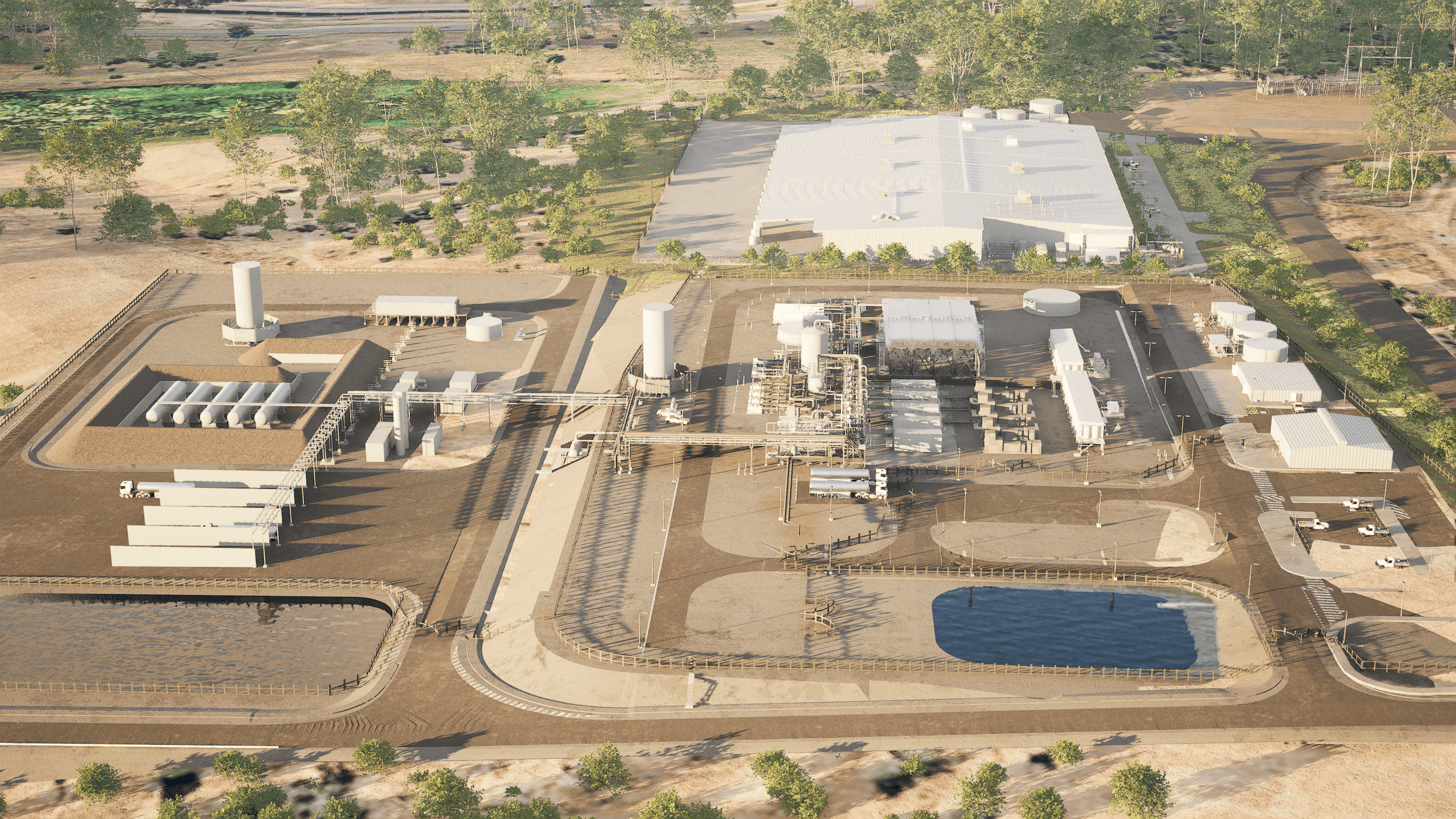
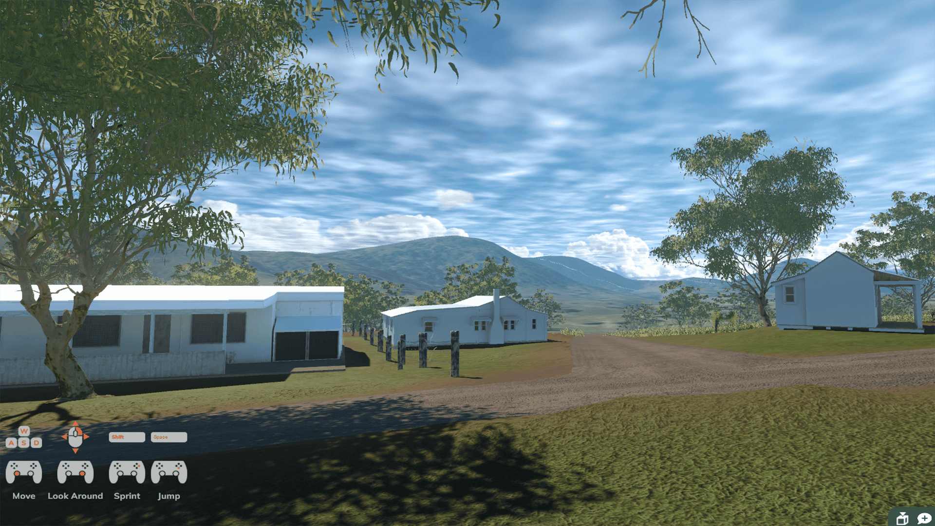
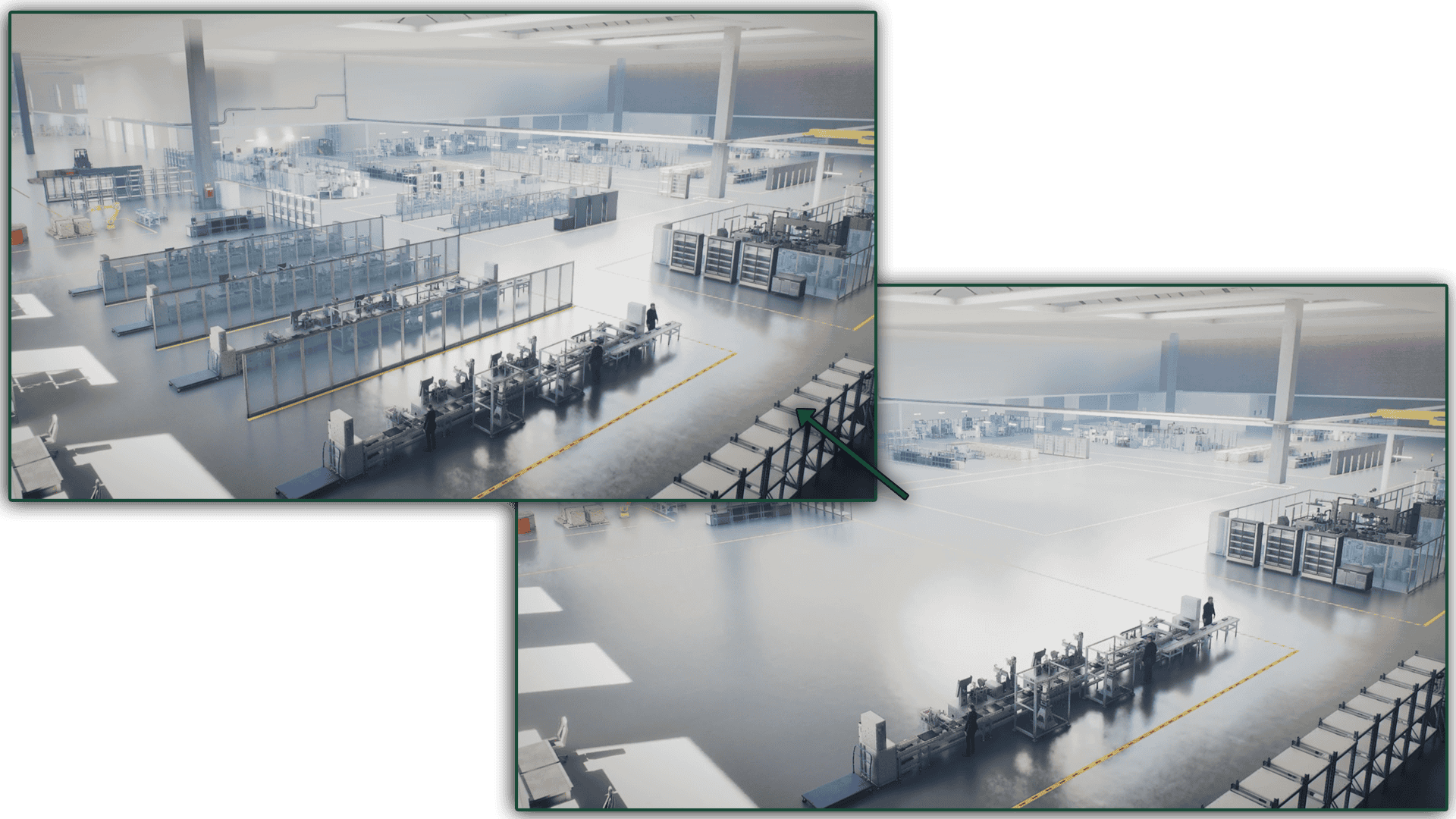
Our MAVI tools are interactive communication tools that consolidate various data points such as satellite imagery, drone footage, GIS data, 3D models, animations, documentation and cultural heritage information into a single, easy-to-use interactive tool. This enables stakeholders to view all relevant information for a proposed project in one location, enhancing the accessibility of the data by presenting technical information in a highly visual and easy-to-understand manner. Our MAVI tools support more transparent communication and informed decision‑making by showing what is planned, where it is located, and how it may affect the country and the community.
Traditional reports and 2D plans can be difficult for non‑technical audiences to interpret, as they lack the 3D aspect that visualisations provide and are often presented using technical jargon and engineering software. In contrast, our MAVI Solutions present information in immersive 3D scenes, VR and interactive tools that are easier to understand for those who are not technically trained or who prefer to communicate in different ways. Our approach enhances clarity, keeps people engaged for longer, and facilitates the building of trust around complex or sensitive projects.
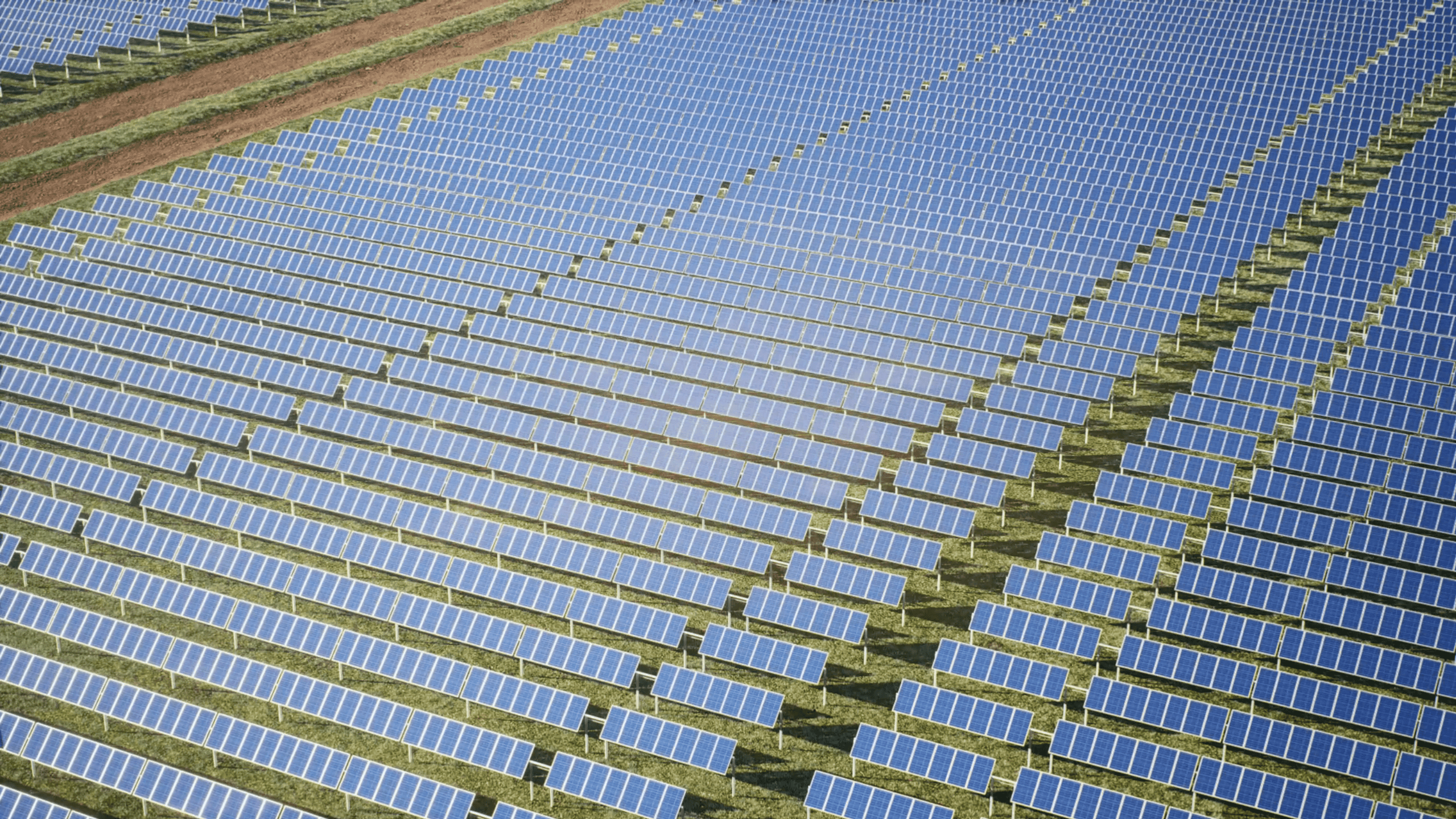
MAVI visualisations are often used across mining, energy, infrastructure and utilities projects where there is a need to communicate impacts, constraints or design options to a diverse group of stakeholders. Typical applications include mine planning, transmission line routes, wind farms, industrial facilities, and broader regional infrastructure programs. However, visualisations and virtual worlds have the versatility to be created for any industry or organisation requiring support for their community engagement and marketing activities. Get in touch with the Sentient team, and we can help you brainstorm options!
Sentient’s MAVI tools were originally developed to help Traditional Owners and other stakeholders understand proposed mining activity on Country. By visualising spatially accurate landscapes and including mine designs alongside Native Title boundaries, important cultural heritage sites, and other sensitive areas in an integrated 3D view, communities receive more orientation and context during heritage, environmental, and approvals processes, which supports co-design and more informed consent. Additionally, our clients, who consult with the Traditional Owners, feel more prepared to field questions and feel that transparency is improved through visualisation.
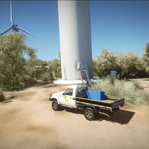
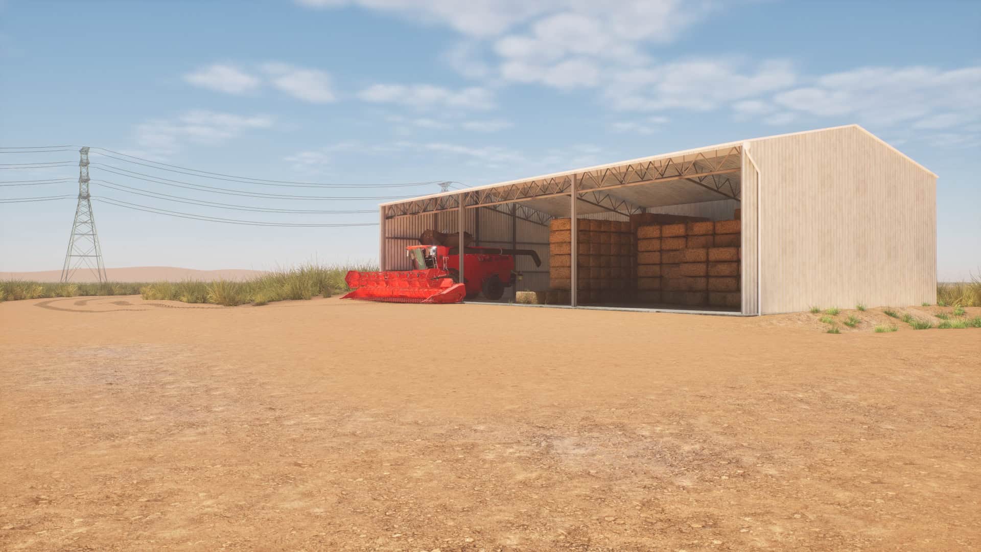
Interactive visualisations, animations, and VR experiences make it easier to explain complex scenarios and keep stakeholders focused on what matters, whether in workshops, one-on-one meetings, or public forums. This leads to more constructive conversations, faster understanding, and better-quality feedback on project options. The spatially accurate virtual worlds also allow stakeholders to view proposed projects from eye-level, giving them a near-real-world perspective of future designs and a better sense of scale than 2D views can provide.
Project teams gain clearer communication of risks and options, fewer misunderstandings, and a stronger social licence by presenting information in transparent, easy‑to‑grasp formats. The interactive tools can also streamline decision-making by consolidating multiple datasets into a single, interactive environment, rather than juggling separate maps, spreadsheets, and reports.
Furthermore, solutions developed for communication and marketing purposes, such as games, interactive apps and immersive rooms built for conferences and exhibitions, bring high engagement and an element of fun to the experience.
MAVI can combine a wide range of inputs, including satellite imagery, drone footage, GIS and survey data, 3D terrain and models, infrastructure layouts, cultural heritage information and environmental constraints. These are brought together into a coherent, navigable 3D map or experience tailored to your project and stakeholder needs. Sentient is capable of processing a wide range of file formats; for more technical details on our preferred file formats, please get in touch, and a list can be provided.
For communications and marketing purposes, Sentient can utilise engineering models, 2D layouts, and reference imagery, as well as existing storyboards, to help design and create a visualisation that meets the customer’s objectives.
The MAVI Solutions team delivers projects through various technologies and mediums, such as
- 2D & 3D Animations and Flythroughs
- Interactive MAVI Tools (Desktop or Web-based)
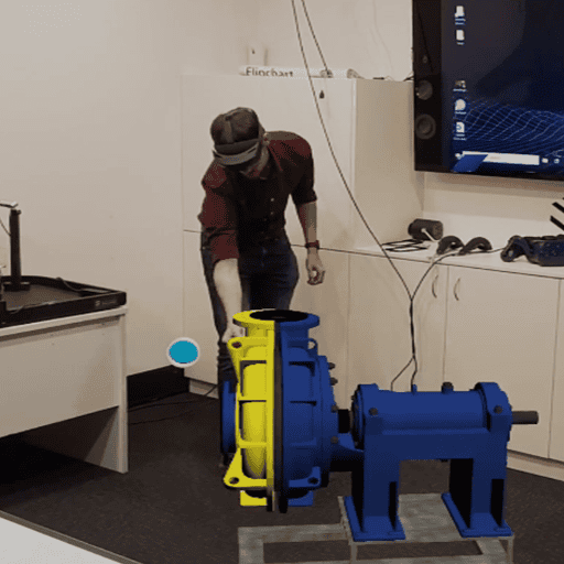
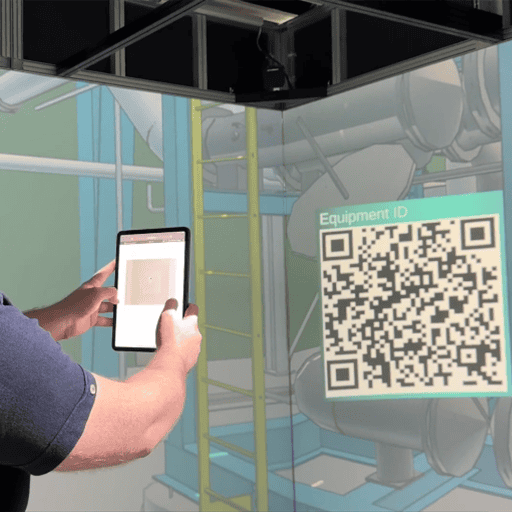
- Virtual Reality (VR) and Augmented Reality (AR) Experiences
- 360-degree Walkthroughs/Tours
- 360-degree Immersive Rooms (Igloo)
- Drone Footage Capture
Have another idea? The Sentient team is well-equipped and happy to support the exploration of new technologies and those not included in this list.
Some technologies have specific technical requirements; however, Sentient understands that all customers, whether big or small, are unique. We aim to support each customer with the best delivery and deployment solution tailored to their specific needs.
MAVI tools can be delivered as offline executable programs or online through the web. For computer-based solutions, the team will discuss deployment, hosting and support requirements during the project scoping phase. For VR/AR and Immersive Room experiences, Sentient can provide or advise on appropriate hardware, suppliers and setups as part of project planning and provide support upon delivery.
The MAVI team works closely with you to define objectives, gather and validate data, then design and build the 3D scenes and interactive tools that best support your engagement plan. During development, Sentient prefers to work in an iterative and collaborative manner with our customers to ensure accurate and successful delivery of all projects.
Solutions can be used at conferences, community meetings, workshops and executive briefings, as well as embedded into ongoing consultation processes. If ongoing hosting or deployment support is required, Sentient can provide this for an additional cost, which can be discussed during the scoping phase.
If you’re keen to explore options for your project, please get in touch with the team today. We can arrange an obligation-free brainstorming session where you can share your challenges and ideas, and we’ll provide some possible solutions. Once a visualisation solution is agreed upon, we can provide a quote for your consideration.
Sentient treats both project data and culturally sensitive heritage information as confidential and only uses it for the purposes agreed with our clients and stakeholders. Access is restricted to authorised team members, supported by technical controls such as secure storage, encryption and role based access so that information is not shared inappropriately.
For culturally sensitive heritage information, including sites, stories and locations, Sentient works under the direction of Traditional Owners and relevant custodians and only visualises or shares what has been explicitly approved for each engagement. Where necessary, sensitive content is generalised, de-identified or excluded from public-facing material, while still allowing stakeholders to understand project impacts and options.
All handling of personal and project information follows Sentient’s privacy policies and applicable data protection legislation, and clients can request more detail on how their data is stored, who can access it and how long it is retained.
The most value is created when MAVI is engaged early in planning, so key constraints, community values and project options can be visualised before decisions are locked in. However, the tools can also be introduced later to support approvals, consultation phases and change management around existing projects.
Sentient is located in the Perth CBD and can organise in-person demonstrations for those in the area; otherwise, all MAVI Solutions can be demoed online through video calls as required. Examples of all Sentient’s shareable projects can be found on our website and YouTube channel.
You can contact Sentient through our website or LinkedIn to discuss your project. Afterwards, the MAVI Solutions team will scope the requirements, data sources, timelines, and budget with you. From there, the team proposes a tailored visualisation and engagement solution aligned to your objectives and engagement landscape for your consideration. Once approved, the team will hold a kick-off meeting and begin developing the solution in an iterative and collaborative manner with the customer project team.
Projects at Sentient vary significantly in size and complexity, depending on the project’s requirements. Typically, MAVI Solutions projects range between 2 weeks and 3 months’ worth of development time. Projects may extend further due to review periods and the availability of subject matter experts. Sentient will work with the client to build an estimated timeline for all projects during the scoping phase and can be flexible with resources depending on the urgency of the project.